Our Services
Aerial & Terrestrial Topography
Comprehensive Mapping Solutions: From High-Altitude Aerial Scans to Precision Ground Measurements.
Capturing the World in High Definition.
Modern topographic mapping demands more than just ground measurements. At TEKNIKA, we integrate the speed of UAV Photogrammetry & LiDAR with the accuracy of Terrestrial Surveys to produce precise Digital Terrain Models (DTM) and contour maps.” “Our methodology enables rapid data acquisition over large areas while penetrating dense vegetation using advanced LiDAR sensors. The result is detailed spatial data essential for mining planning, infrastructure development, and environmental analysis.
Why Choose Teknika?
Multi-Sensor Fusion
We combine high-resolution aerial imagery (RGB) with LiDAR Point Clouds to generate realistic and accurate 3D visualizations.
Vegetation Penetration
Our LiDAR technology is capable of penetrating dense canopy cover to map the true ground surface (Bare Earth), which is often hidden in conventional surveys.
Rapid Data Acquisition
High efficiency with the capability to cover thousands of hectares in short timeframes using our fleet of Multirotor and Fixed-wing UAVs.
Our Mapping Methodologies
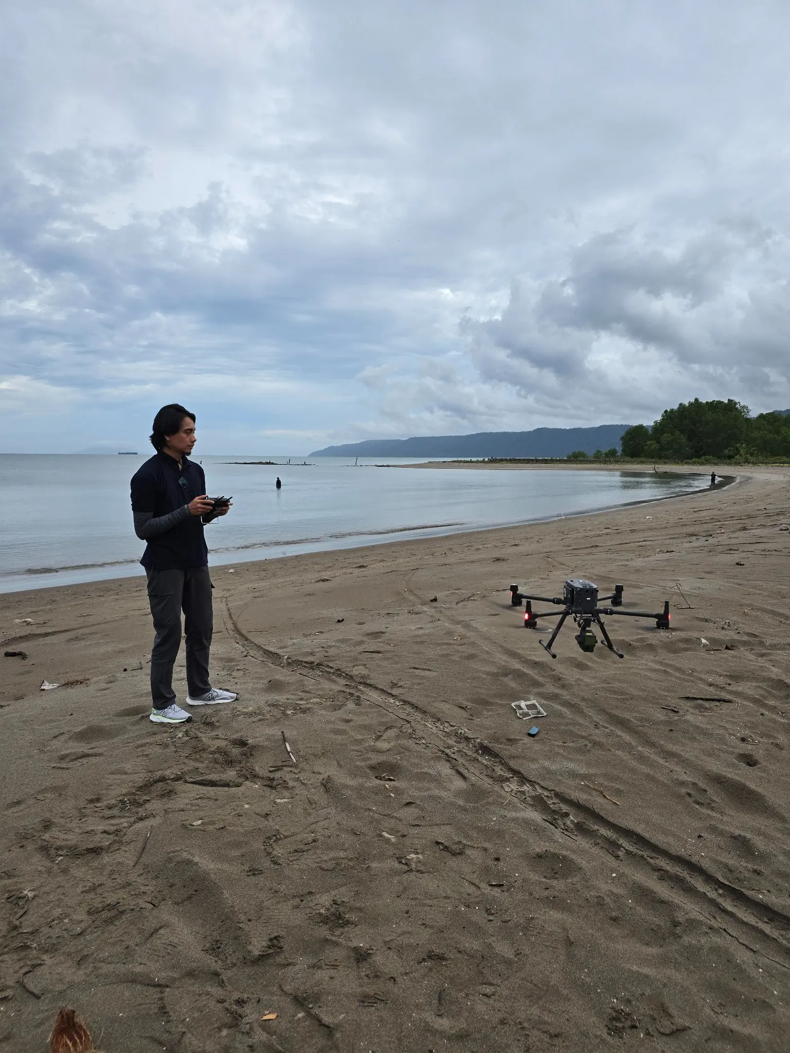
UAV LiDAR Scanning
Deployment of active LiDAR sensors on drones to generate dense 3D point clouds. This is highly effective for mapping topography in vegetation-covered areas (forests/plantations) where standard photogrammetry falls short.
Ground Control Survey (GCP)
Installation and measurement of Ground Control Points (GCP & ICP) using Geodetic GNSS to ensure aerial data is accurately tied to the national coordinate system.
Aerial Photogrammetry
Acquisition of thousands of high-resolution aerial photos processed into Orthophoto Mosaics and Digital Surface Models (DSM) for visual asset documentation and land use analysis.
Digital Terrain Modeling (DTM)
Advanced processing to separate above-ground objects (trees, buildings) from the true ground surface, producing contour maps ready for Engineering Design.
Industries we Serve
Mining & Quarry
Stockpile volume calculation and greenfield area mapping.
Infrastructure Design
Feasibility studies for roads, railways, and dams.
Urban Planning
City cadastral mapping and spatial planning.
Environmental Monitoring
Land cover analysis and landscape change monitoring.
Ready to Map Your Project’s Success?
Our experts bring extensive experience supporting diverse industries such as mining, oil and gas, renewable energy, forestry, and plantations. This expertise enables us to deliver solutions that meet technical requirements and create positive impacts across industries.

We are dedicated to developing solutions that keep pace with industrial technology trends. Our goal is to meet every client need through innovative, superior quality solutions at competitive rates.
Contact Us
- Jl. A. Yani No.245, Cihapit, Kec. Bandung Wetan, Kota Bandung, Jawa Barat 40114
- survey@teknikaspasial.co.id
- +62811228665