Utilities & Inspection
Powerline Monitoring Using UAV LiDAR
Ensuring Grid Reliability for SUTET Network in West Java.
Industry
Energy / Utilities
Service
UAV LiDAR Survey
Year
2022
Volume
82 Tower Spans
The Objective
Maintaining SUTET Grid Reliability
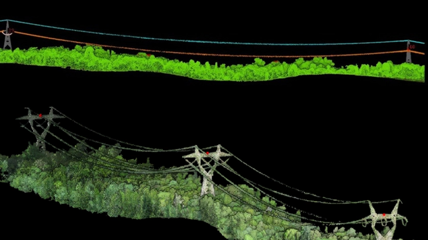
This project focused on monitoring the Extra High Voltage Power Line Network (SUTET) in the Bandung-Sumedang area. The primary objective was to maintain the electrical grid’s reliability by detecting potential obstructions and confirming that the infrastructure met the strict operational standards specified by PLN. The survey covered 82 spans (tower-to-tower) of critical powerlines.
Our Solution
Precision LiDAR Inspection
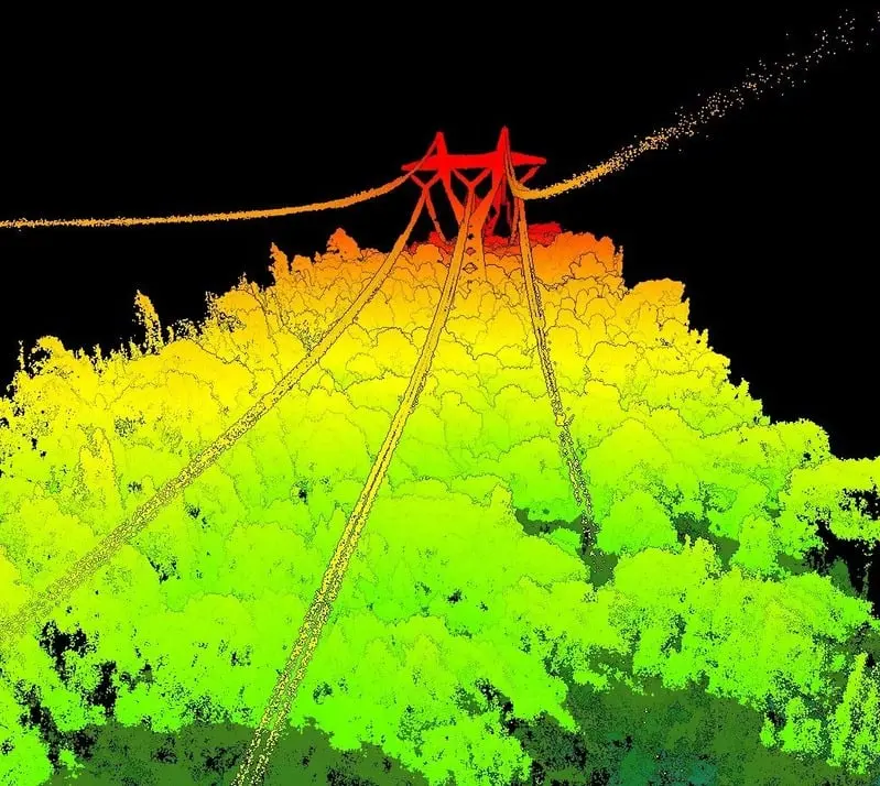
TEKNIKA deployed UAV LiDAR survey technology to capture high-fidelity spatial data. The process began with a preliminary field survey to assess local conditions and establish control points. Data acquisition was executed along pre-planned flight paths, carefully adapted to site-specific conditions.
Key Results
The 3-Stage Framework Report
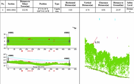
The final output is a comprehensive geospatial analysis compiled into a detailed report following PLN’s three-stage framework. This framework assesses compliance, identifies risk factors, and provides actionable recommendations for maintenance and improvement to ensure safe clearance and hazard mitigation.
- Survey Type: UAV LiDAR
- Asset Type: SUTET (Extra High Voltage)
- Analysis: Clearance & Encroachment
- Standard: PLN Regulations
Ready to Map Your Project’s Success?
Our experts bring extensive experience supporting diverse industries such as mining, oil and gas, renewable energy, forestry, and plantations. This expertise enables us to deliver solutions that meet technical requirements and create positive impacts across industries.

We are dedicated to developing solutions that keep pace with industrial technology trends. Our goal is to meet every client need through innovative, superior quality solutions at competitive rates.
Contact Us
- Jl. A. Yani No.245, Cihapit, Kec. Bandung Wetan, Kota Bandung, Jawa Barat 40114
- survey@teknikaspasial.co.id
- +62811228665