Our Services
Precision Positioning & Engineering Survey
High-Accuracy Terrestrial Mapping for Infrastructure, Mining, and Cadastral Needs.
Establishing the Ground Truth.
In every construction and land development project, positional accuracy is the primary foundation. Our Terrestrial Survey services provide high-precision geospatial data for land boundary determination, detailed topographic measurement, and construction stake-out.” “We integrate advanced Total Station technology with GNSS (Global Navigation Satellite System) to produce reliable measurements, even in challenging terrains. Our team ensures every data point is captured with the highest standard of precision to support crucial technical decision-making.
Why Choose Teknika?
Certified Professionals
Supported by certified Junior Experts (Level 7) from LSP Geospasial and competent Surveyors.
Hybrid Technology
Integration of GNSS RTK methods for open areas and Electronic Total Station (ETS) for signal-restricted areas or those requiring millimeter precision.
Adaptive Field Execution
Proven operational capability in extreme terrains, ranging from steep elevation variations (300-600m) to dense forest areas.
Our Survey Methodologies
Construction Stake-Out
We translate digital designs into the physical field with high precision. This service ensures that every construction element (piles, foundations, excavation limits) is positioned according to the planned coordinates to minimize structural error risks.
Boundary & Cadastral Survey
Determination of legal and accurate land boundaries using National Land Agency (BPN) standards. We install permanent Benchmarks (BM) to ensure legal certainty for property assets and mining concessions.
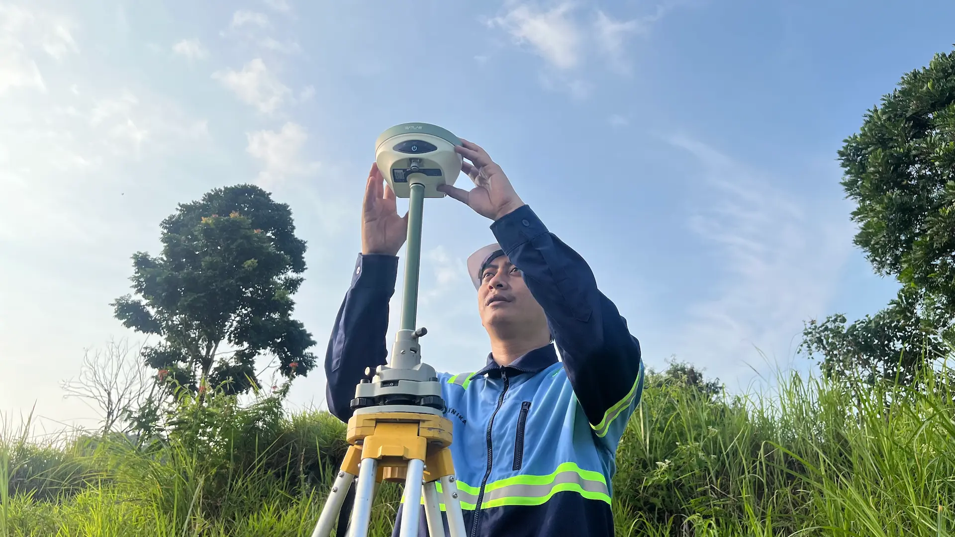
Hybrid GNSS & Total Station Workflow
Dual-technology integration for optimal results. We utilize GNSS RTK (Real-Time Kinematic) supported by NTRIP systems for open areas, combined with Electronic Total Stations (ETS) for signal-restricted zones or areas requiring millimeter precision.
Detailed Topography Mapping
Comprehensive situational mapping covering ground contours, man-made features (roads, buildings), and natural features for Engineering Design and environmental management needs.
Industries we Serve
Infrastructure Construction
Precise measurements for the development of highways, bridges, and public utilities.
Mining Exploration
Determination of exploration drill points, mining concession boundaries, and stockpile volume monitoring.
Land Development
Planning for residential areas, industrial estates, and commercial land development.
Utilities & Power Lines
Corridor mapping for High Voltage Power Lines (SUTET), gas pipelines, and irrigation networks.
Ready to Map Your Project’s Success?
Our experts bring extensive experience supporting diverse industries such as mining, oil and gas, renewable energy, forestry, and plantations. This expertise enables us to deliver solutions that meet technical requirements and create positive impacts across industries.

We are dedicated to developing solutions that keep pace with industrial technology trends. Our goal is to meet every client need through innovative, superior quality solutions at competitive rates.
Contact Us
- Jl. A. Yani No.245, Cihapit, Kec. Bandung Wetan, Kota Bandung, Jawa Barat 40114
- survey@teknikaspasial.co.id
- +62811228665