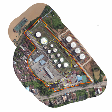
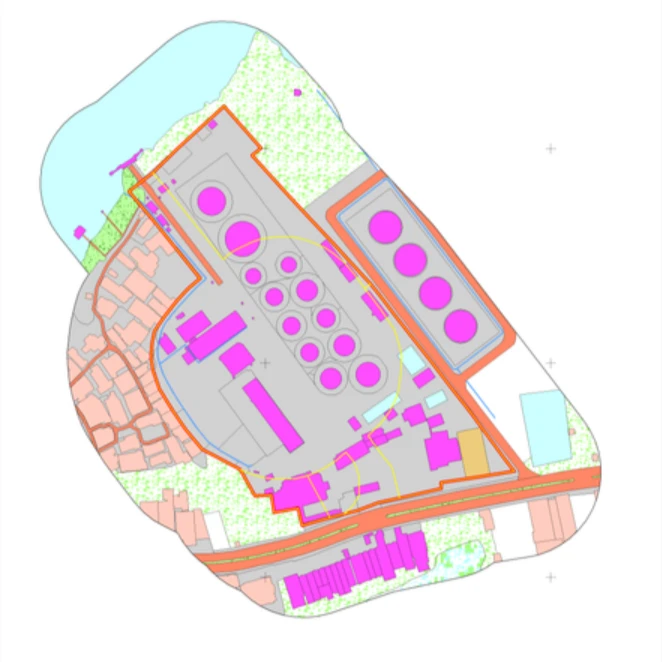
Digitalizing National Assets
This extensive project involved topographic mapping and asset documentation across PT Pertamina (Persero) operational areas in Sumatra, Kalimantan-Java, and Eastern Indonesia. The primary goal was to prepare high-accuracy survey data for integration into Pertamina’s WEBGIS. This initiative aims to improve asset management processes by increasing efficiency and effectiveness, requiring precise delineation of land boundaries and detailed situational mapping according to corporate standards.
Advanced Aerial & Ground Integration
The method deployed utilized Aerial Drone Photogrammetry with high-resolution cameras to acquire detailed imagery. To guarantee corporate-grade accuracy, the aerial data was supported by ground surveys using GNSS technology with RTK methods to establish precise control points. This combination ensured that surface contours and land cover data met strict operational requirements.
Strategic Spatial Data
The survey successfully covered 6.655,93 hectares across 368 distinct assets. Processed data—including Orthophotos, Digital Terrain Models (DTMs), and land cover classifications—was made available through the ArcGIS platform for easy access. This project significantly improved the accuracy of Pertamina’s spatial data, directly underpinning strategic decision-making.